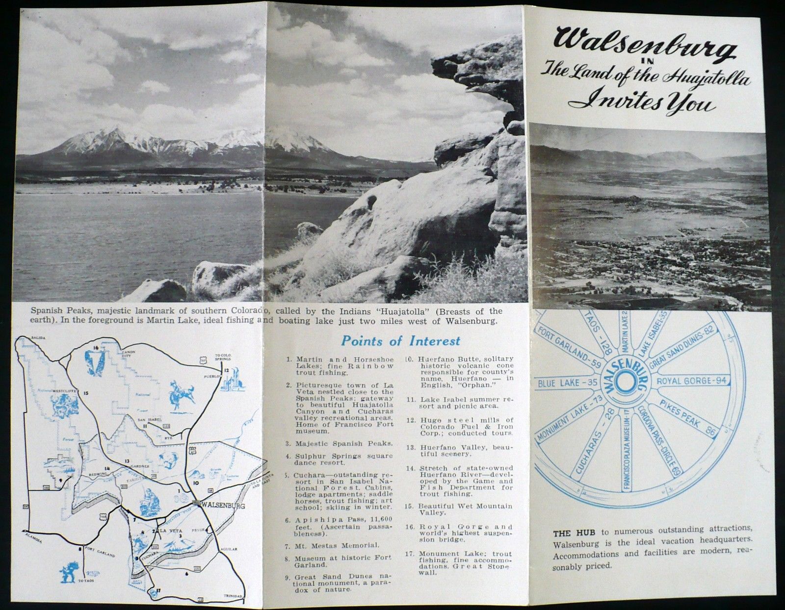
Here’s an interesting map of the Walsenburg, Colorado, area.
“B369-W. [Travel Brocure]. Circa 1950s tri-fold black and white brochure for “Walsenberg in The Land of the Huajatolla Invites You”, (Colorado). Fully open brochure measures 8-1/2 x 11″. Front panel shows an aerial view of the city and Walsenburg at the Hub of spoked wheel showing distances to other attractions in Colorado and neighboring states. The two back panels have a pictorial map of southern Colorado showing National Forests and Monuments, cities, recreational activities and major roads. Points of Interest are located by numbers on the map and described in a Key. B/w photo of Spanish Peaks and Martin Lake.
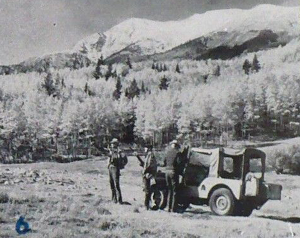
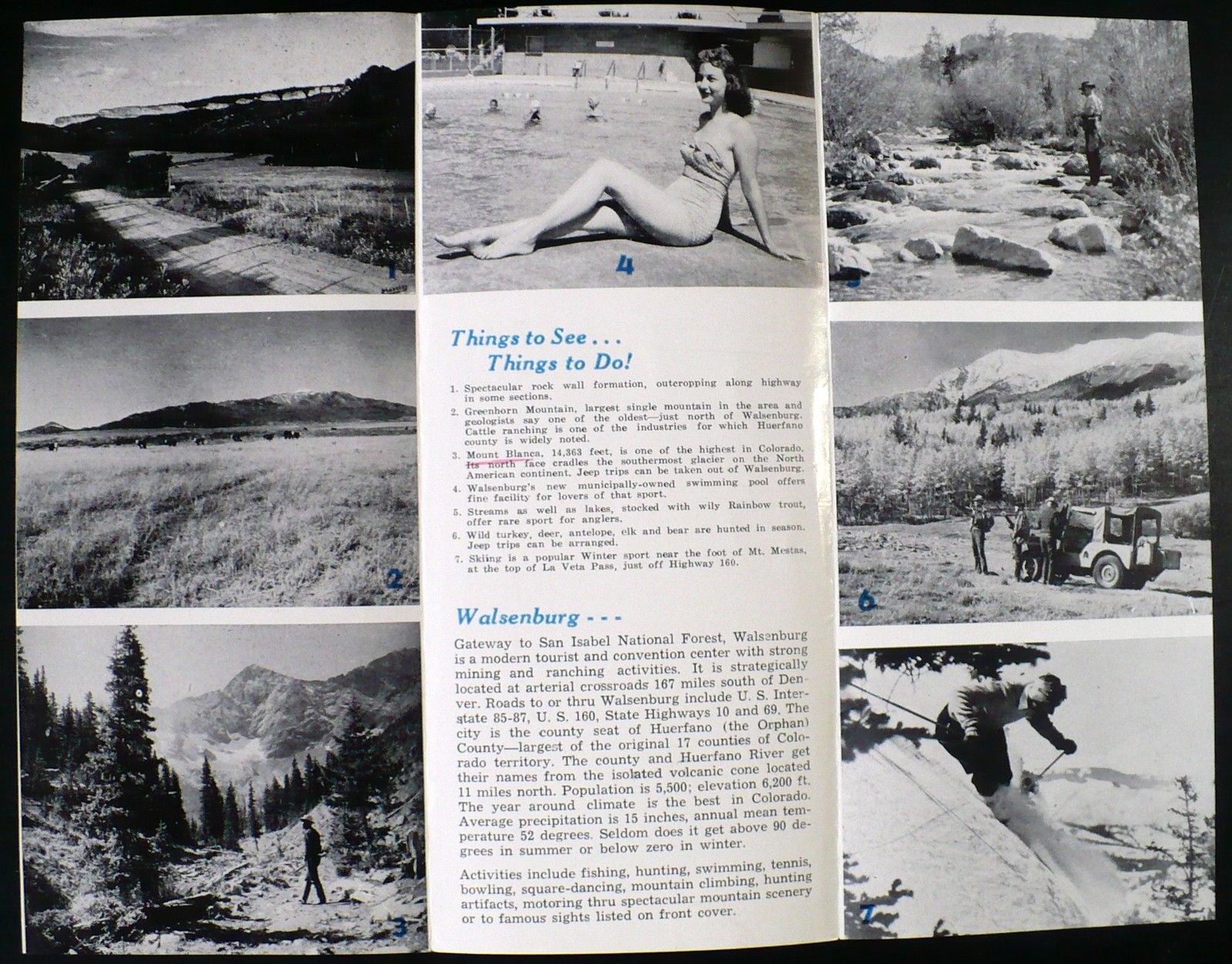
The opposite side of brochure has descriptive text (Population was 5,500) and 7 b/w photos with keyed numbers referring to their captons in “Things to See…Things to Do!” Photos show spectacular rock formations; Greenhorn Mountain with Cattle ranching in the Valley; Man carrying rifle in a forest below Mount Blanca; pretty bathing beauty relaxing at the municipally-owned swimming pool; Rainbow trout fishing in a small stream; Seasonal Jeep hunting trips for deer, antelope, elk and bear; and Skiing at foot of Mt. Mestas, at the top of La Veta Pass, just off Highway 160.”
View all the information on eBay