<– Day 13 – March 30: From Cottonwood Canyon to Wolverine | Overview | Day 15 – April 1: From Cathedral Valley to I-70 –>
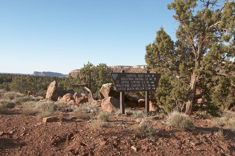
Sunday March 31 day break at Horse Canyon.
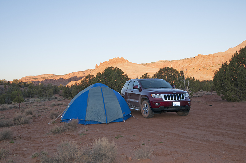
Technically, the March 30th night we camped at the Horse Canyon trailhead wasn’t allowed by the NPS. However, had we walked through the gate to the wilderness study area we could camp legally. Besides, it wasn’t like we hadn’t tried to find a camping spot in other places. Since we were all alone, we didn’t think it was a big deal. We didn’t make a fire and we left no trace we were there. Just the same, we broke camp at sunlight and began our second day in Utah.
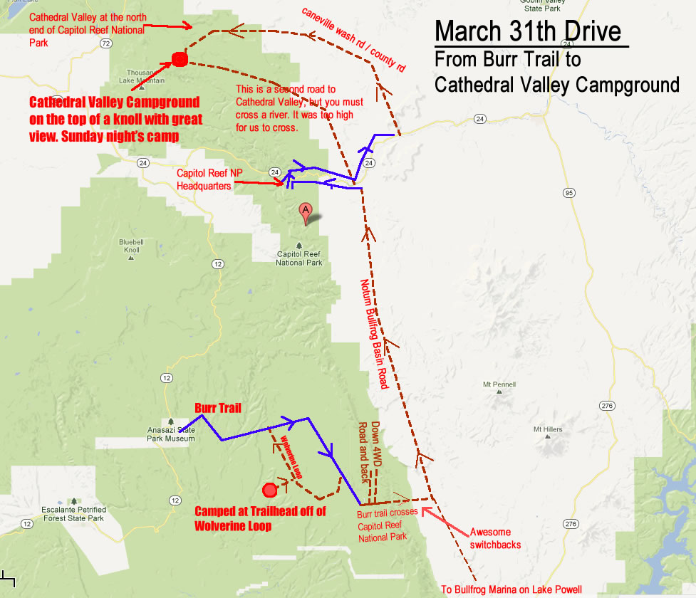
We’d planned to return to Highway 12 once we got back to the Burr Trail. But, one thing I’d never done was cross Capitol Reef NP on the Burr Trail and then head north (normally I’ve driven south to Bullfrog Marina on Lake Powell). Ann was all for the impromptu route, so we drove north on the Wolverine Loop and headed east. Along the way we took a few photos (surprise, surprise).
Wolverine Loop Trail
The western entrance to the Wolverine Loop from the Burr Trail. This is all within the Grand Staircase Escalante National Monument.
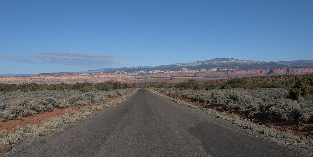
Looking West on the Burr Trail Road. The early morning sun was lighting up the hillsides.

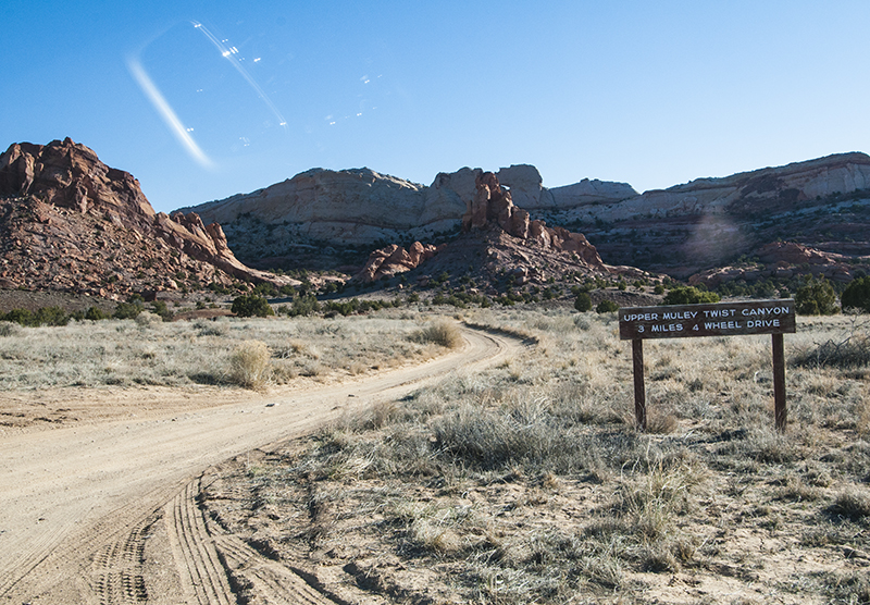
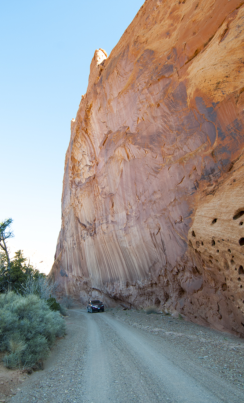
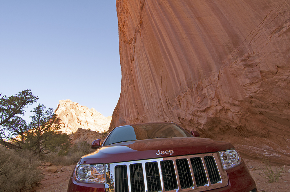
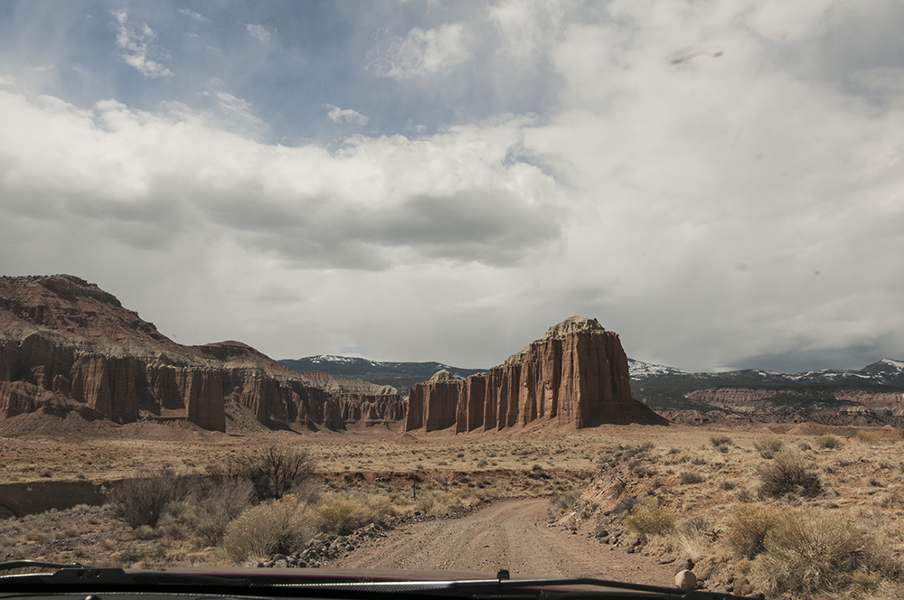
Eventually the pavement of the Burr Trail ended at the Capitol Reef NP boundary. A half-mile into the park we encountered Lower Muley Twist Canyon, a trail for four wheel drive vehicles. Of course, we had to check it out. It turned out to be a tight, twisting trail through a dry wash with amazing rock scenery. We took a lot of pictures. Here are a few:
After playing on the trail, we drove back to the Burr Trail and began our ascent over the ‘reef’ portion of National Park, a rock formation that reminds one of the back of a Stegosaurus. While the drive from the western side of the reef is a gentle slope, the eastern side consists of a series of cool switchbacks.
This photo shows the Burr Trail heading to the West.
This is the switchbacks on the eastern side of the reef.
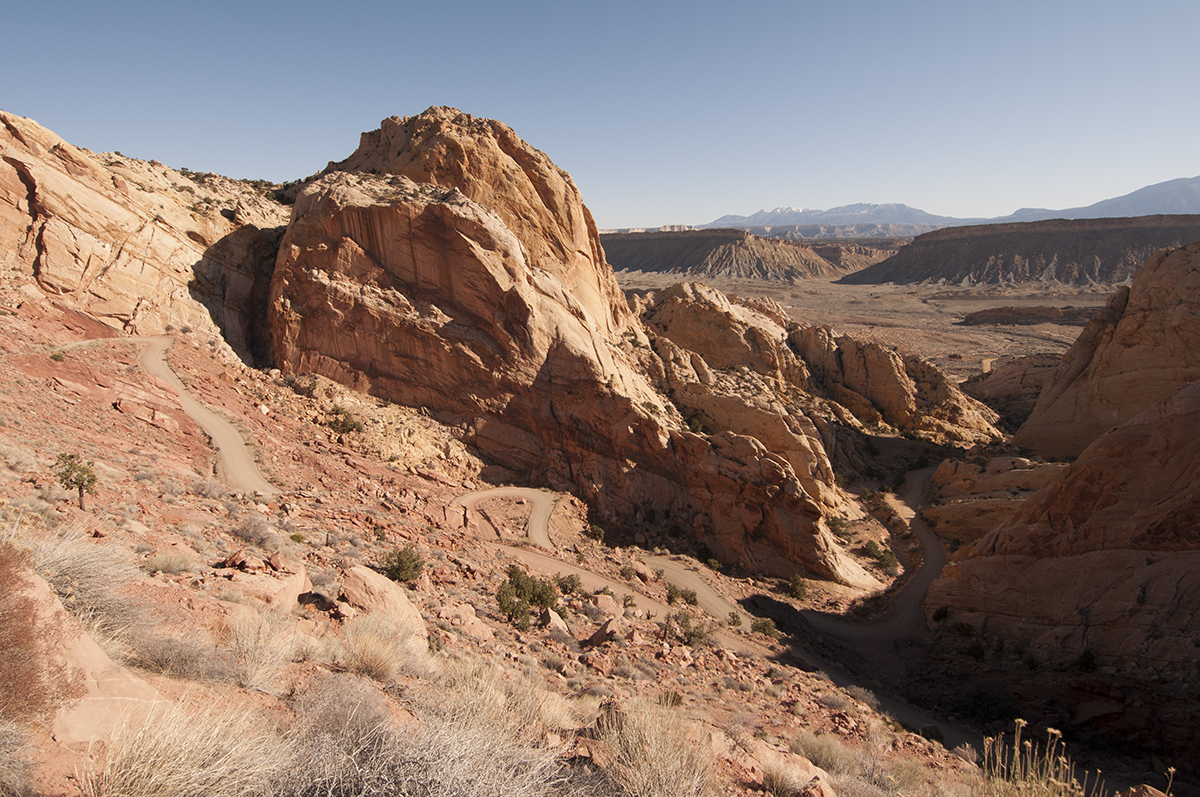
Here’s another look at the switchbacks.
After we negotiated the switchbacks, Burr trail ended at the Notum Bullfront Basin Road. That’s where we turned north. Unfortunately this road was pretty uninteresting. It was a dusty, dirty road that finally ended at HIghway 24. Since we both had to go to the bathroom, I drove to the Capitol Reef NP Headquarters.
While we were there, I grabbed a park map. That’s when I discovered the Cathedral Valley Campground in the far north section of the park that could only be accessed with dirt roads. Neither Ann or I had been there. I talked with the Ranger and asked him about the camp spot. He said there were only six camping spots. I asked what the chances were it would be full. He replied it was almost never full; most likely, we’d be the only people there. Even better, it was right next to the National Forest, so if it were full, we could always camp in the National Forest anywhere we wanted. That’s all we had to hear. With a destination finalized, we took some pictures before we left.
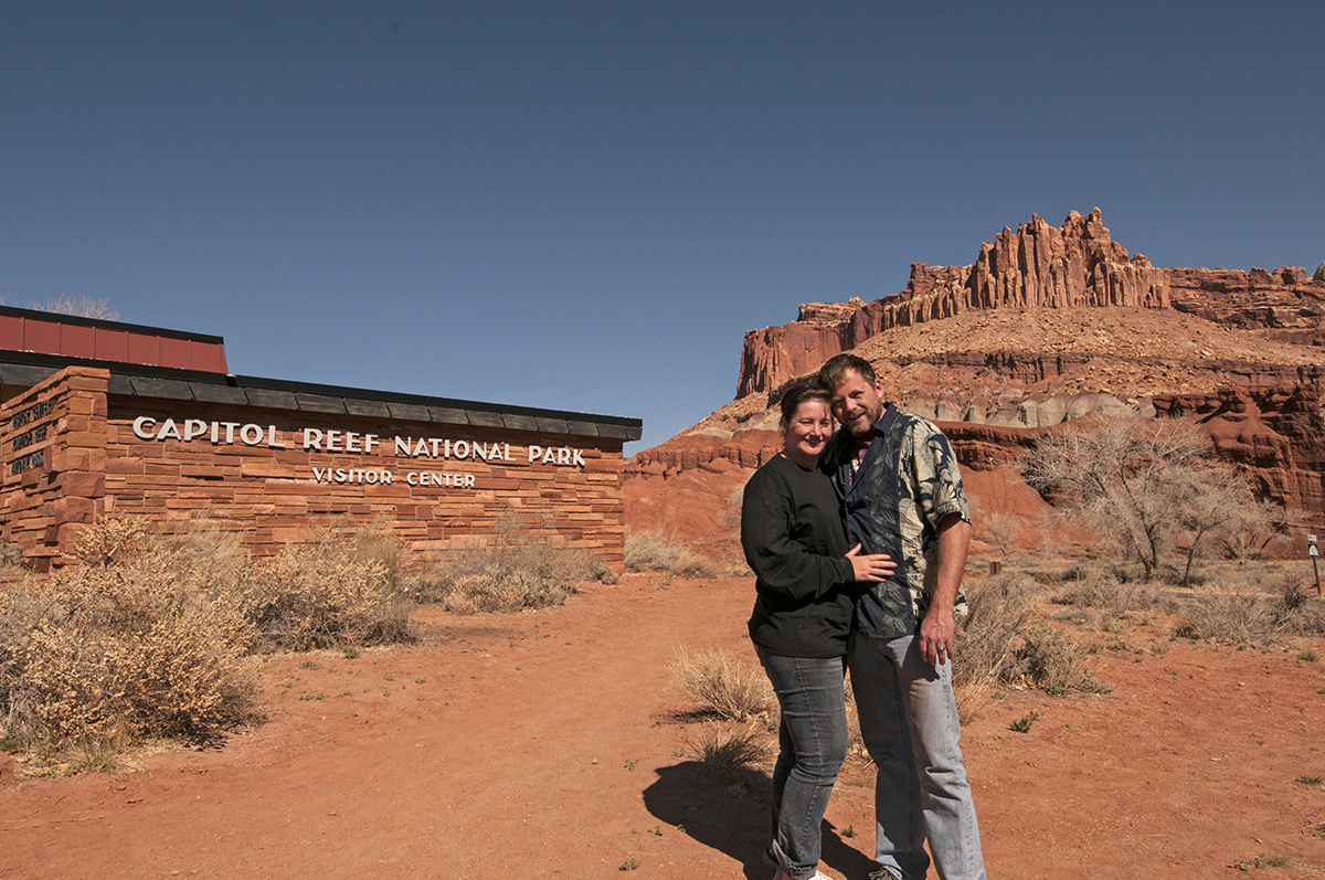
Us in front of the NP Headquarters
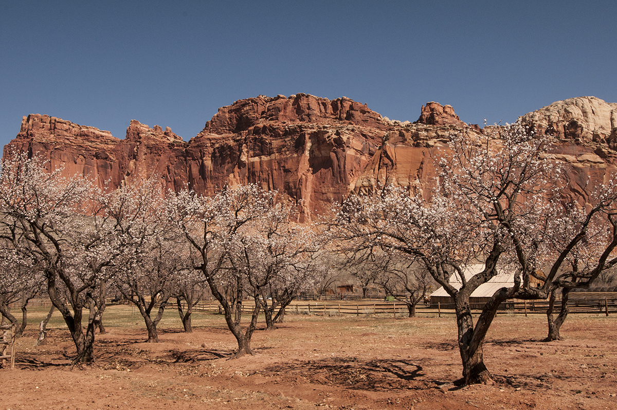
The fruit trees has just started to bloom when Ann took this photo.
It turns out there are two access roads to Cathedral Valley from Highway 24. I didn’t understand why until we tried the first road and encountered a river. I’m sure at certain times of the year, this wash was passable, but on Sunday it wasn’t:
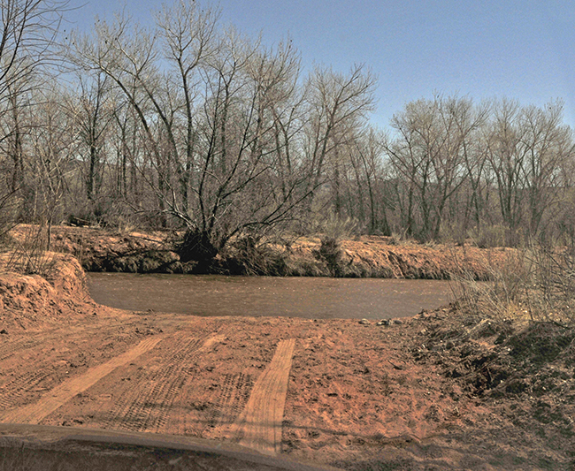
The first road to Cathedral Valley was impassable due to a high river. The camera took this shot really dark, so I had to adjust it in photoshop, hence the funny coloring.
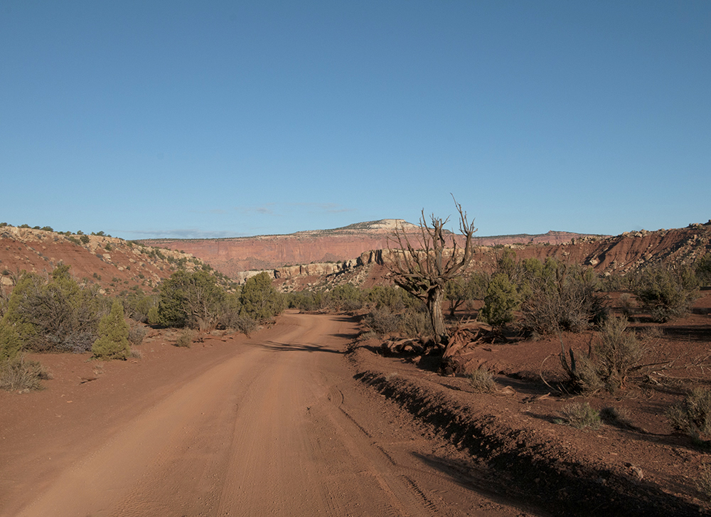
We returned to Highway 24 and found the second road, called Caneville Wash Rd. I learned that this and other back country dirt roads in this part of Utah are all maintained by the county when they can get to them. Even the ones inside the National Park.
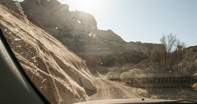
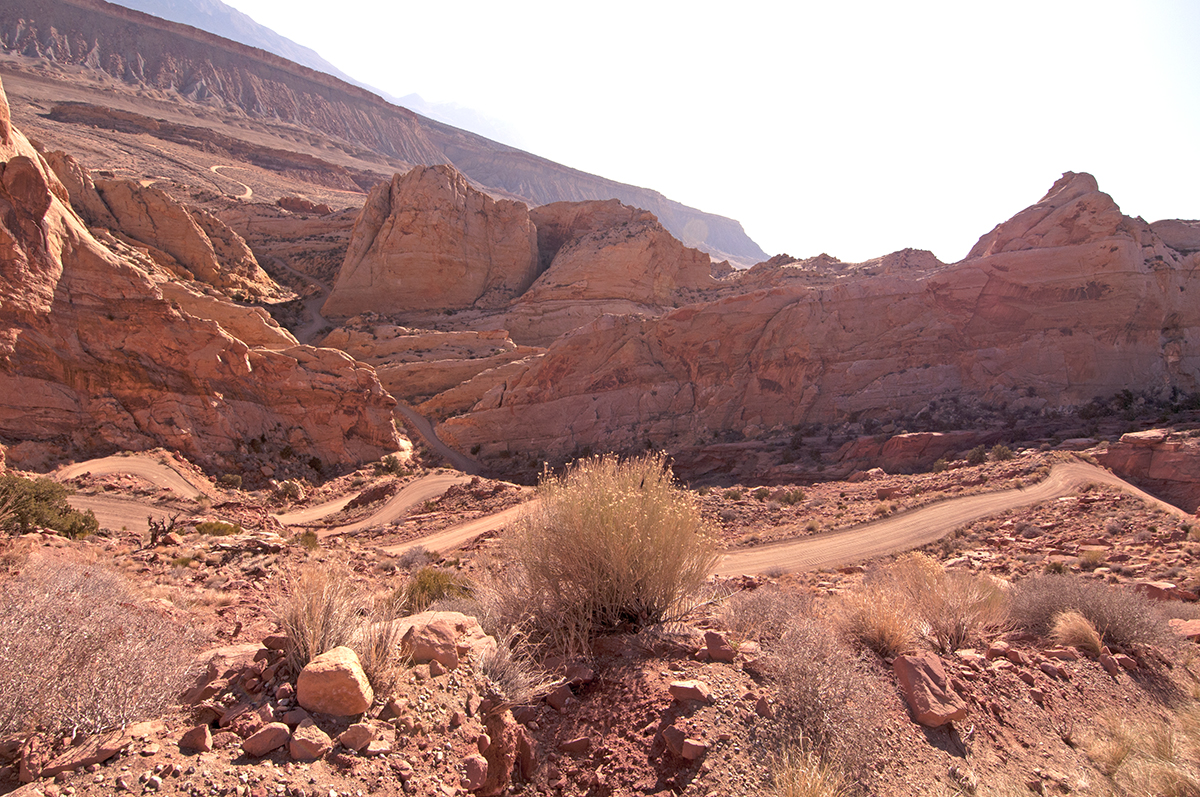
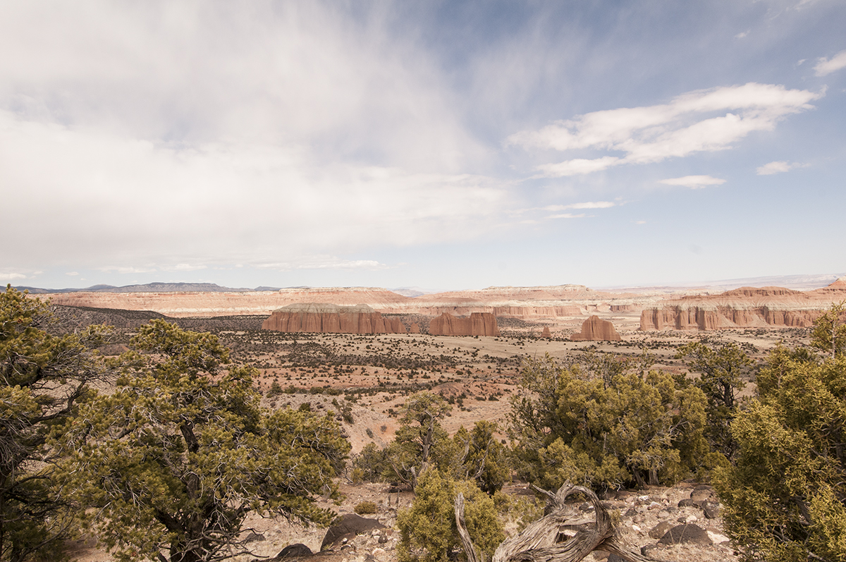
The Caneville road was a collection of twists and turns lasting 30 miles (the sign said 24, but we our counter registered 31 miles). The road circumvents rough areas of the National Park, then crosses directly through Cathedral Valley, before climbing a steep, rocky hill with some switchbacks.
Near Cathedral Valley
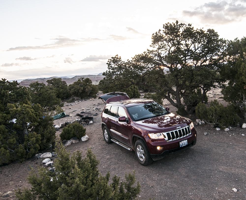
When we reached the top of the hill, we found the campground. There was one tent set up, at the entrance to the campground, but no one ever occupied it. We had the campground to ourselves and our choice of camping areas. The campground had great fire bins, an aluminum picnic table at each site and plenty of flat spaces for a tents. A clean pit toilet was located nearby, too. We can’t wait to go back and spend a few days there.
This is the view from our camping spot overlooking Cathedral Valley.
After a short while, we settle into our chairs and started a fire. Then, it started to rain. Not to be deterred from having fun we covered ourselves and continued enjoying the fire.

Eventually Dusk arrived, so we climbed into our tent. The next morning we awoke early, so I snapped this photo.
This was taken April 1 at sunrise.
<– Day 13 – March 30: From Cottonwood Canyon to Wolverine | Overview | Day 15 – April 1: From Cathedral Valley to I-70 –>
Dave, you are a lucky man to be able to travel like that. That is a beautiful trip you are on and it seems that you sure know how to enjoy the little things in life. Thank you for taking me along on your trip thru writings and pictures, I appreciate it. Tom
Well maybe there is something to see West of the Mississippi !
But really Dave if you’re going to be camping where it’s not allowed, you should at least have some camouflage netting ! The blue tent can be seen for miles.
Dave and Ann-
You are having a great adventure enjoying the beauty of the western United States. The areas you have traveled are beautiful and basically un marred by humans. Take in only what you need, take nothing but your trash out, leave only footprints. Not too many folks would be looking at your blue tent in that part of Utah!! Great photos!
The pictures look stunning even on my iPhone. Thanks for taking the time to share this trip with us!